Bing daily wallpapers
page 2 / 20
| 2026‑10‑12 ‑ | Brazil |
|---|
| pt | • | Brinquedos tradicionais de miriti expostos durante o Círio de Nazaré em Belém, Pará |
| (© Ricardo Lima/Getty Images) |
Happy Children's Day!
Boats that don't need a river, birds that don't need the sky and planes that depart from anywhere. In Belém, miriti toys transform childhood into a small fleet of adventures. Made with the light wood of the miritizeiro and painted in vibrant colors, they appear as fish, dolls, animals, boats and everyday scenes and gain prominence during the Círio de Nazaré. According to local reports, these toys have accompanied the festival since its first procession in 1793, many of them carried by promisers as a thank you for graces achieved.
So light that it has earned the nickname "Styrofoam of the Amazon", the miriti seems tailor-made for the costume. On Children's Day, it is worth remembering that a good toy is not necessarily what makes the most things: it is what makes the imagination go further. Perhaps this is why these miriti boats continue to sail after so many centuries. Not through the rivers of the Amazon, but through a territory without a map: the world of stories created by those who set them in motion.




| 2026‑10‑12 ‑ | Spain |
|---|
| es | • | La Patrulla Águila sobrevuela durante el Desfile Militar del Día Nacional, Madrid, España |
| (© Carlos Alvarez/Getty Images) |
National Day of Spain
The Eagle Patrol flies over Madrid (Spain) leaving the red and yellow of the flag in the sky: for four decades it was the most awaited image of the National Day parade, the day that is celebrated every October 12 and that a law set on that date in 1987.
The central act is presided over by the king and queen and combines a land and air parade, with the jump of the paratroopers. The overflight with colored fumes became a trademark of the house: the patrol was born in 1985 at the General Air Academy of San Javier (Murcia), flew with seven Spanish-made CASA C-101 Aviojets and was one of the few aerobatic teams in the world that used yellow smoke.
It is worth knowing that the photo belongs to another era: the C-101s were retired in 2025 and since then the flyby has been signed by the Blackbird Formation, with five Pilatus PC-21s.



| 2026‑10‑12 ‑ | Japan |
|---|---|
| 2026‑09‑15 ‑ | International / Canada ‑ English / Canada ‑ French / China / France / Germany / India / Italy / Spain / United Kingdom | 2026‑09‑11 ‑ | Brazil |
| de | • | Grünflügelaras |
| en | • | Red-and-green macaws |
| es | • | Guacamayos aliverdes, Brasil |
| fr | • | Aras chloroptères, Amérique du Sud |
| it | • | L'ara dalle ali verdi, Brasile |
| ja | • | ベニコンゴウインコのペア |
| pt | • | Araras-vermelhas, América do Sul |
| zh | • | 红绿金刚鹦鹉 |
| (© markes51/Getty Images) |
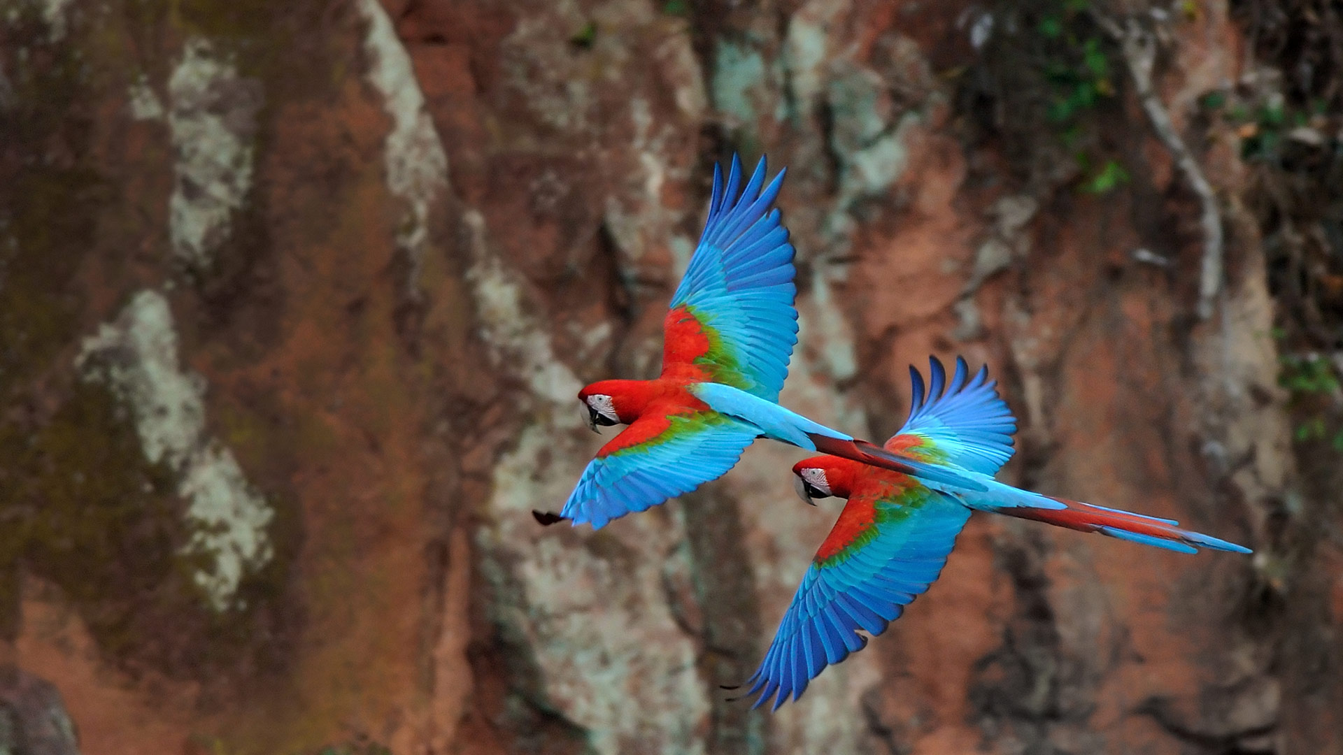
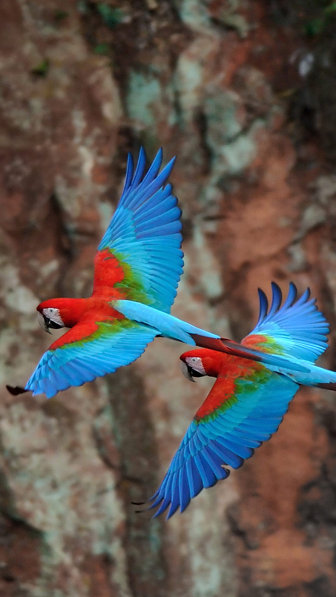
Red-and-green macaws
Evolution occasionally favours maximalism. Just look at these red-and-green macaws with their scarlet plumage, vivid green wings and blue flight feathers. Their lives unfold across tropical South America, in a routine that connects fruit, seeds and soil in ways that are easy to miss from the ground.
Among the world's largest parrots, red-and-green macaws can reach about 90 centimetres from beak to tail. Oversized bills pry open tough fruits and nuts, while swallowed and discarded seeds help new plants take root. The plumage helps individuals communicate, recognise one another and stand out in the crowded rainforest.
Their social lives are just as colourful. Macaws mate for life and rarely stray far from their partners, communicating through calls that ring across the canopy. They're also among the bird world's brainiacs, pairing curiosity with the problem-solving skills parrots are known for. With bright feathers, formidable beaks, lifelong partnerships and a knack for turning lunch into reforestation, subtle was never the assignment.


| 2026‑10‑11 ‑ | International / Brazil / Canada ‑ English / Canada ‑ French / China / France / India / Japan / Spain / United Kingdom / United States |
|---|
| en | • | Glade Creek Grist Mill, Babcock State Park, West Virginia |
| • | Glade Creek Grist Mill, Babcock State Park, West Virginia, United States | |
| • | Glade Creek Grist Mill, Babcock State Park, West Virginia, USA | |
| es | • | Molino de Glade Creek, Parque Estatal Babcock, Virginia Occidental, EE. UU. |
| fr | • | Moulin de Glade Creek, parc d'État de Babcock, Virginie-Occidentale, États-Unis |
| ja | • | グレイド・クリーク・グリスト・ミル, 米国 ウェストバージニア州 |
| pt | • | Moinho de Glade Creek, Parque Estadual Babcock, Virgínia Ocidental, EUA |
| zh | • | 格莱德溪磨坊,巴布科克州立公园,西弗吉尼亚州,美国 |
| (© dszc/Getty Images) |
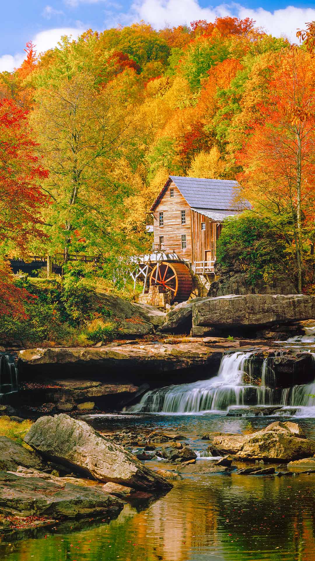
Glade Creek Grist Mill, Babcock State Park, West Virginia, USA
Surrounded by a patchwork of red, orange and gold, Glade Creek Grist Mill stands above the rocky waters of Glade Creek in West Virginia's Babcock State Park, United States. Although it looks like a relic from the pioneer era, the mill is actually a carefully crafted tribute to Appalachia's milling heritage.
Completed in 1976, the mill was built using parts salvaged from several historic gristmills once scattered across West Virginia, bringing together pieces of the state's rural past in a single working structure. Water from Glade Creek still turns the wheel and powers traditional grain-grinding demonstrations, offering visitors a glimpse into a way of life once common throughout the Appalachian Mountains.
The mill may be the park's most recognisable landmark, but it is only part of the story. Each autumn, Babcock State Park's forests transform into a mosaic of brilliant colour, framing waterfalls, rocky streambeds and kilometres of hiking trails. Together, the landscape and mill create an enduring symbol of Appalachian history, craftsmanship and natural beauty.


| 2026‑10‑11 ‑ | Germany |
|---|
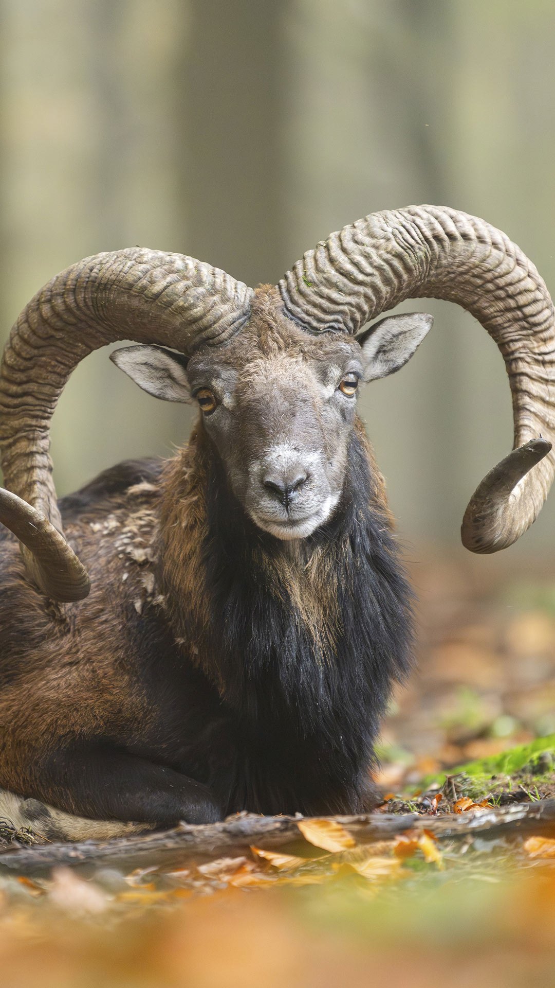
| de | • | Europäisches Mufflon (Widder) im Herbstwald, Bayern |
| (© imageBROKER/David & Micha Sheldon/Getty Images) |
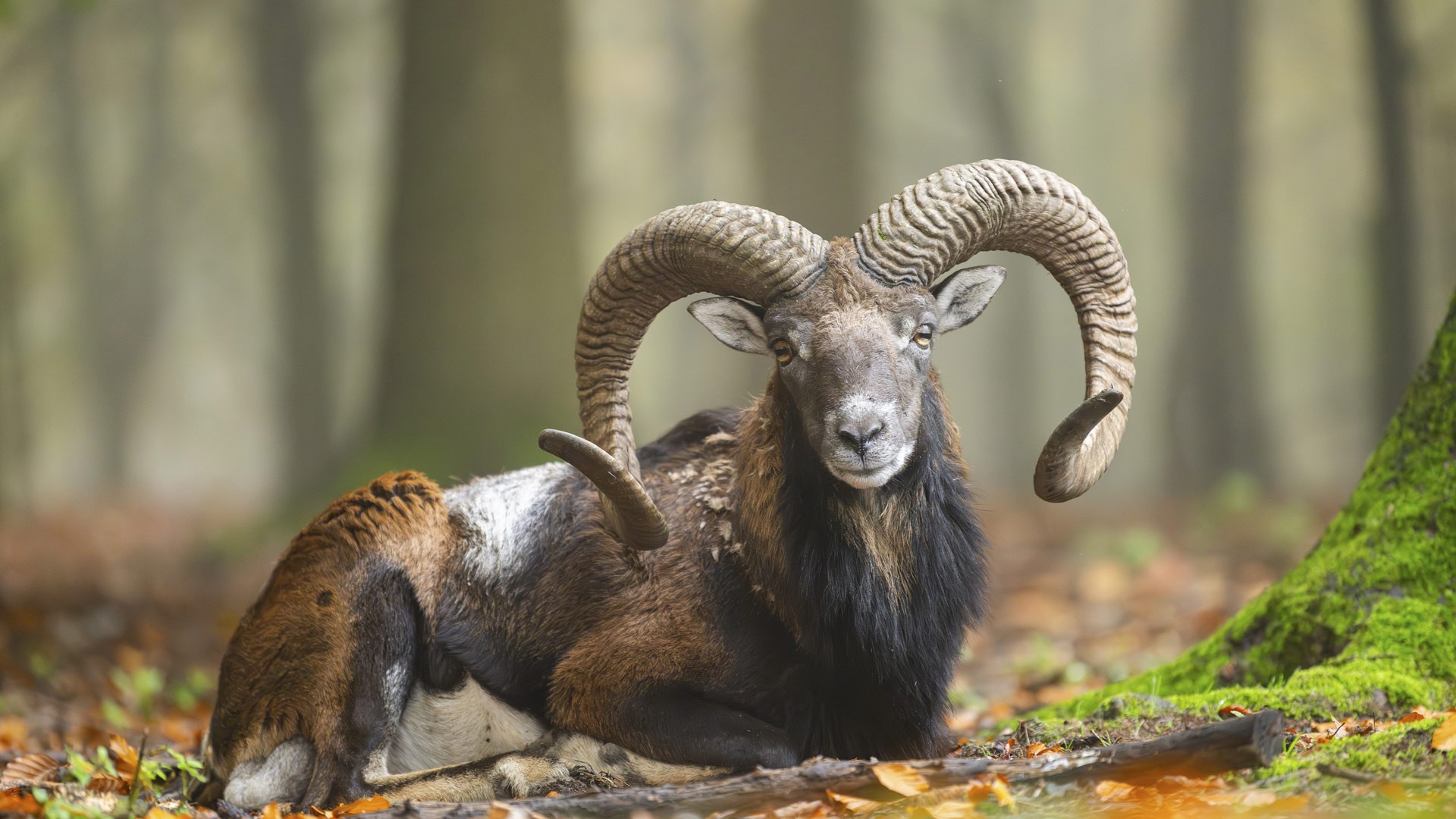
European mouflon (ram) in the autumn forest, Bavaria
When autumn bathes the forests of Bavaria in warm brown and gold tones, a particularly attractive season begins for many wild animals. One of them is the European mouflon sheep, a subspecies of wild sheep with a long history in Europe. In our picture, a ram has settled between leaves and moss. Its powerful, snail-shaped curved horns make it unmistakable. Originally, mouflons were mainly found in Corsica and Sardinia, but today they are also found in some regions of Central Europe. The animals are alert, agile and excellently adapted to life in varied landscapes.
The male rams in particular attract attention with their striking appearance. In autumn, forests offer them an important retreat and at the same time plenty of food. If you walk through nature with your eyes open, you will rarely encounter a mouflon but often discover traces of its presence. Today's motif shows a quiet moment from the life of an animal, which is considered a symbol of primeval wilderness in many places.
| 2026‑10‑11 ‑ | Italy |
|---|
| it | • | La regata della Barcolana nel Golfo di Trieste, Friuli-Venezia Giulia, Italia |
| (© Marco Saracco/Getty Images) |
The Barcolana of Trieste
The Gulf of Trieste, in Friuli-Venezia Giulia (Italy), is now filled with sails: at 10.30 a.m. a cannon shot kicks off the Barcolana, the most attended sailing regatta on the planet, which closes a week of trials and events on the Rive.
The formula is what makes it unique. From the same starting line, stretched between Barcola and Miramare Castle, the maxi racing cars and the family cabin cruisers start together, on a quadrilateral course of thirteen nautical miles, about twenty-four kilometers, with arrival in front of Piazza Unità d'Italia.
Born in 1969 as an end-of-season regatta with fifty-one boats, it has grown to become a mass event: in 2018 the Guinness Book of Records certified 2,689 boats at the start. The best places to watch it? The Barcola seafront for the start, the Rive and the Molo Audace for the finish, the San Giusto hill to embrace the entire gulf.